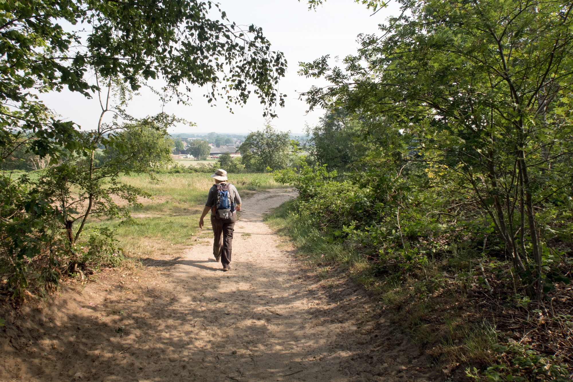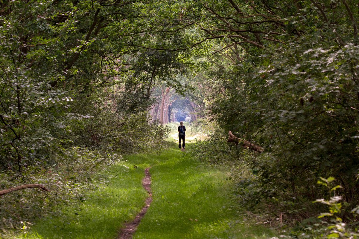
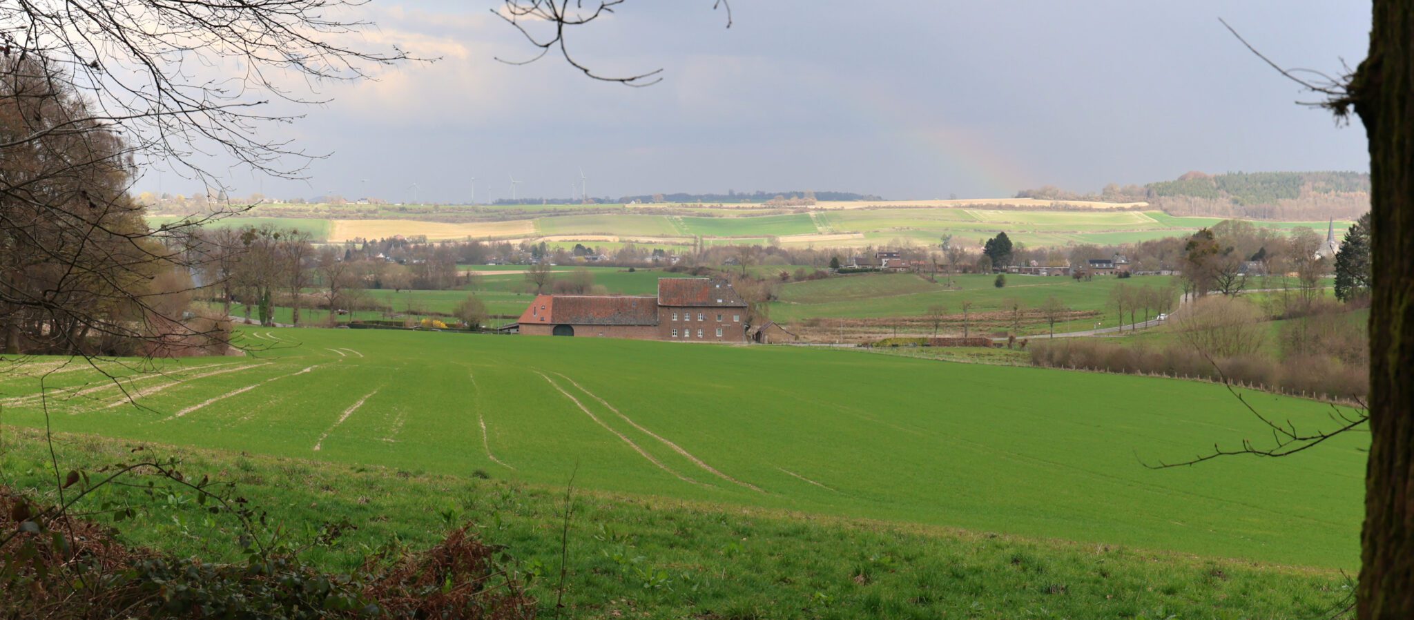
2026-03-12 Vijlenerbos, Geuldal, Limburg
Thursday 12 March 2026, spring hike 12km in the south of the Province Limburg, close to the Belgium …
Sharing Experiences, Information and Photography (info@sharex.nl)
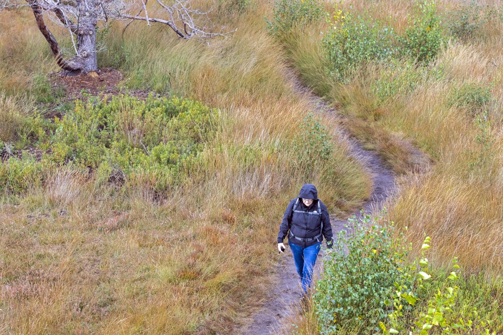
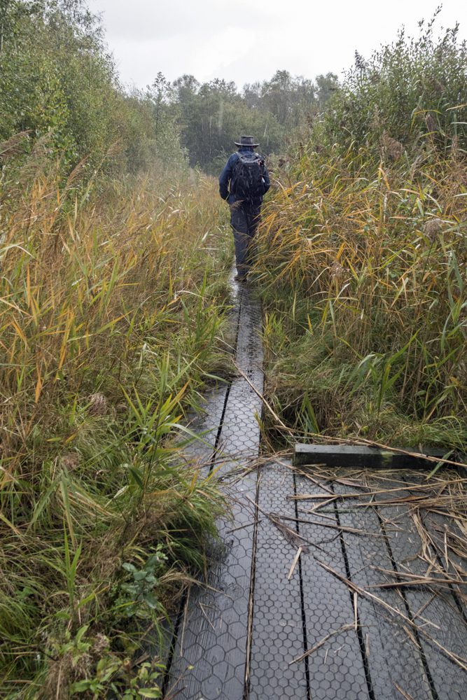
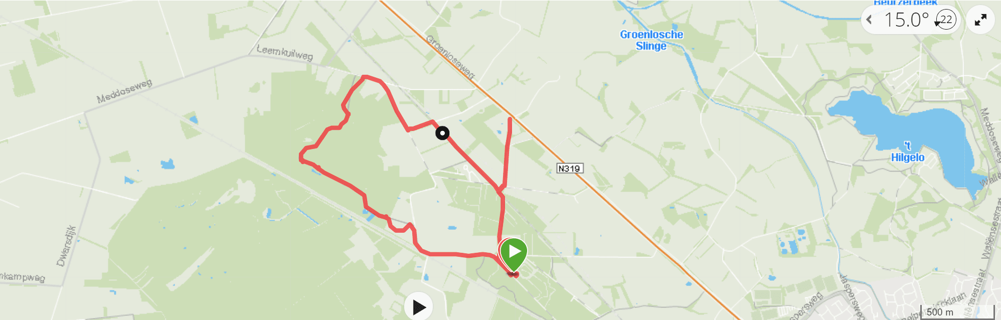
Wednesday 7 October 2020 Wandelroute Korenburgerveen near Winterswijk, province Gelderland, approx 8 km
During a autumn holiday trip we positioned our caravan in Camping het Wieskamp and explored the most eastern part of The Netherlands, adjacent to the German border. Great landscape for hikes and cycling.
This hike; very varied walk, counterclockwise (mandatory during Covid-19 pandemic) the most interesting part – and wettest for that matter – is the (peat)swamp in the end. Make sure to bring waterproof footwear and enjoy this scenery; even in the pooring rain 🙂
Thursday 12 March 2026, spring hike 12km in the south of the Province Limburg, close to the Belgium …
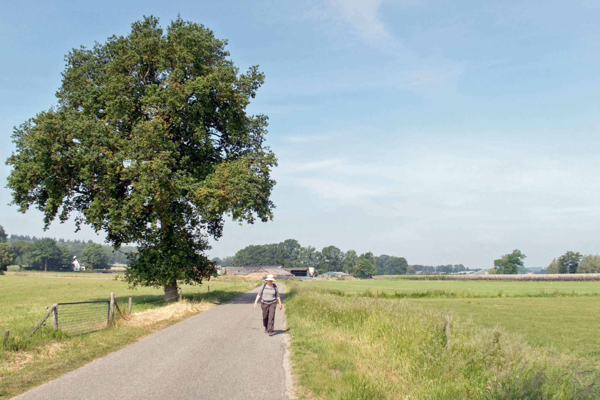
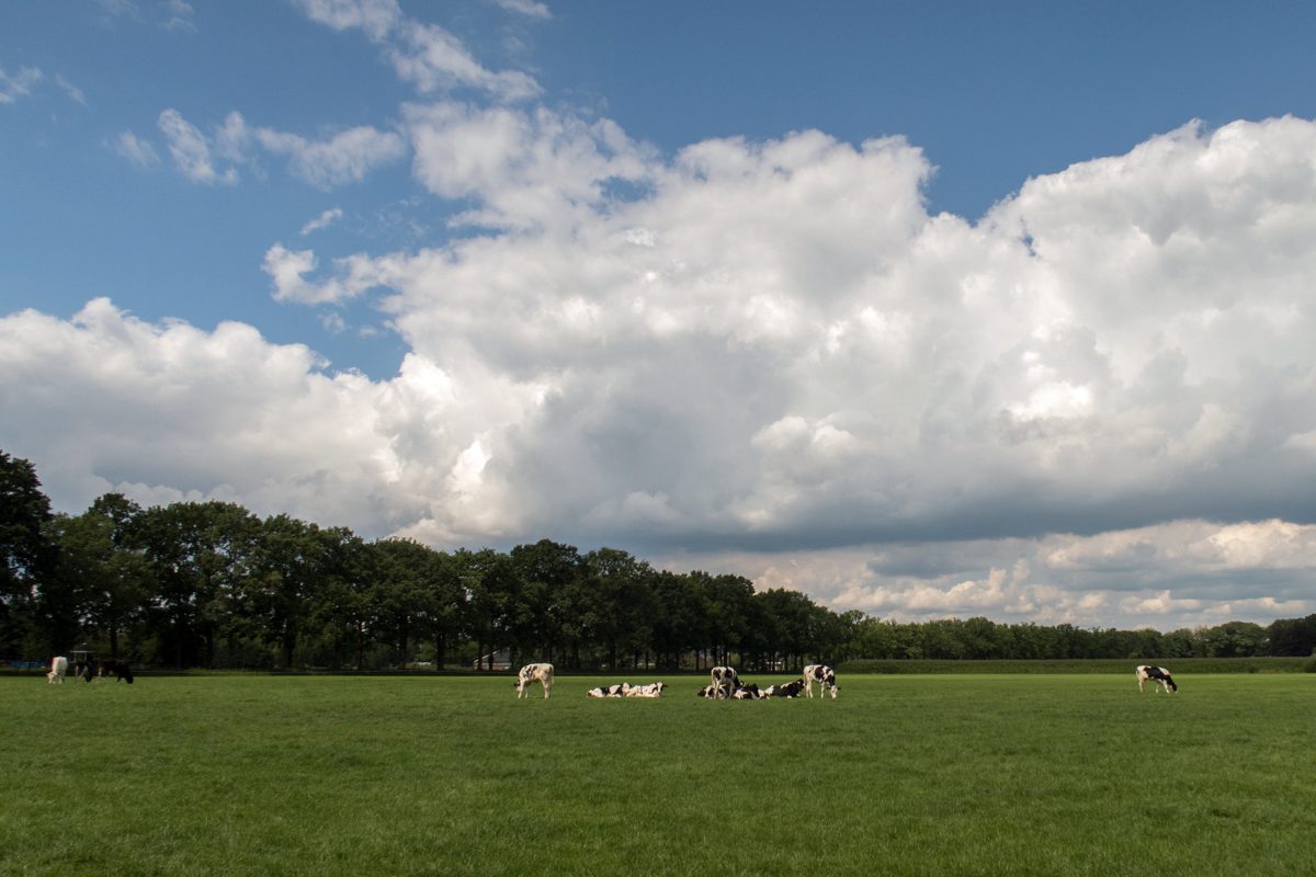
Tuesday 10 March 2026, Spring hike, approx. 8.5 km in the province Limburg. Nice, yet not very spect…

Personal computers play an increasingly important role in HAM radio. In a series of four (4) article…
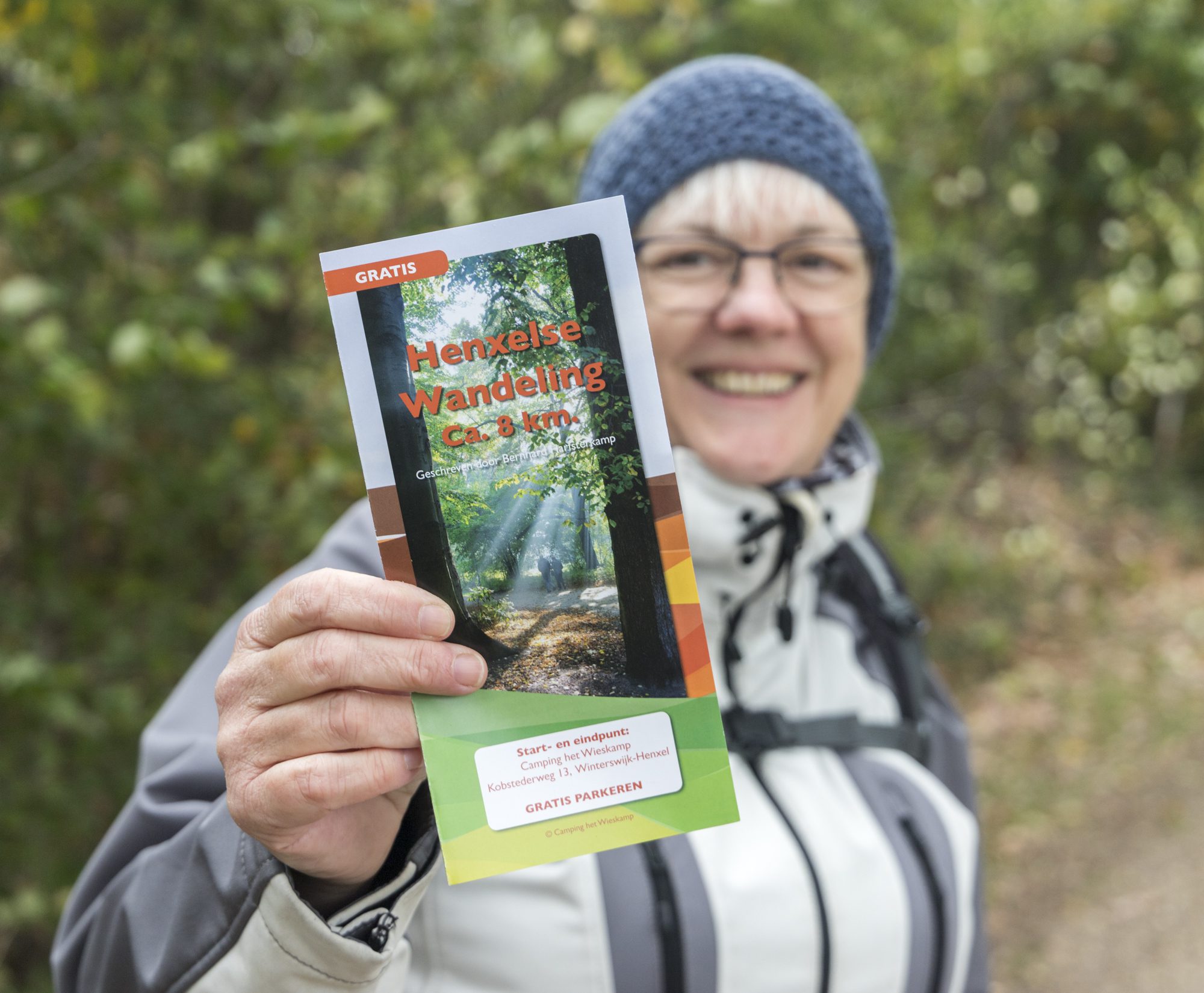
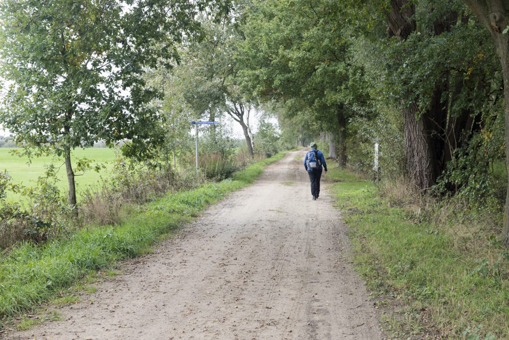
Monday 5 October 2020, Henxelse wandelroute near Winterswijk, province Gelderland, appox 8 km. During a autumn holiday trip we positioned our caravan in Camping het Wieskamp and explored the most eastern part of The Netherlands, adjacent to the German border. Great landscape for hikes and cycling.
This hike; relatively easy going mix of hardened and unhardened paths…. Nice scenery!
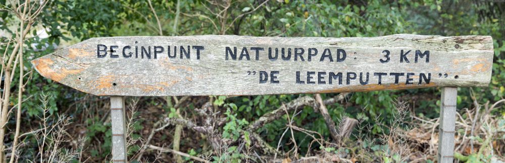
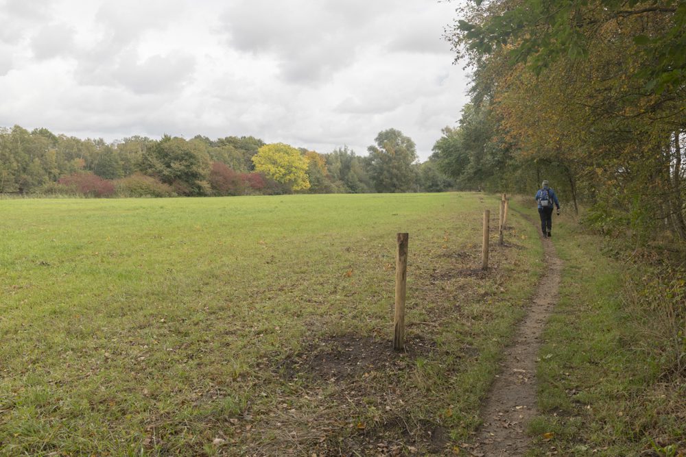
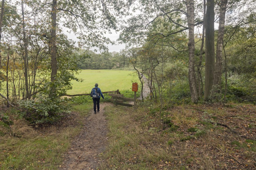
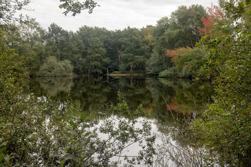
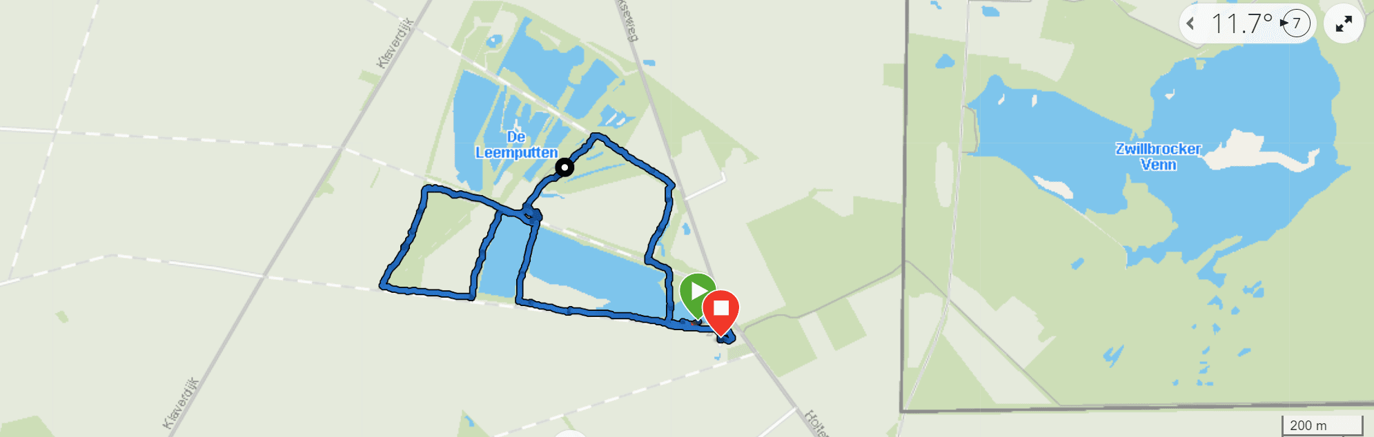
Monday 12 October 2020, Wandelroute De Leemputten near Winterswijk, province Gelderland, approx. 3 km. During a autumn holiday trip we positioned our caravan in Camping het Wieskamp and explored the most eastern part of The Netherlands, adjacent to the German border. Great landscape for hikes and cycling. This hike; final (easy) hike of this camping trip… ‘De Leemputten’, interesting area from a historical perspective although nowadays most people will visit this nature-PARC to enjoy a combination of water and forest. Likely to be very busy during holidays and weekends…
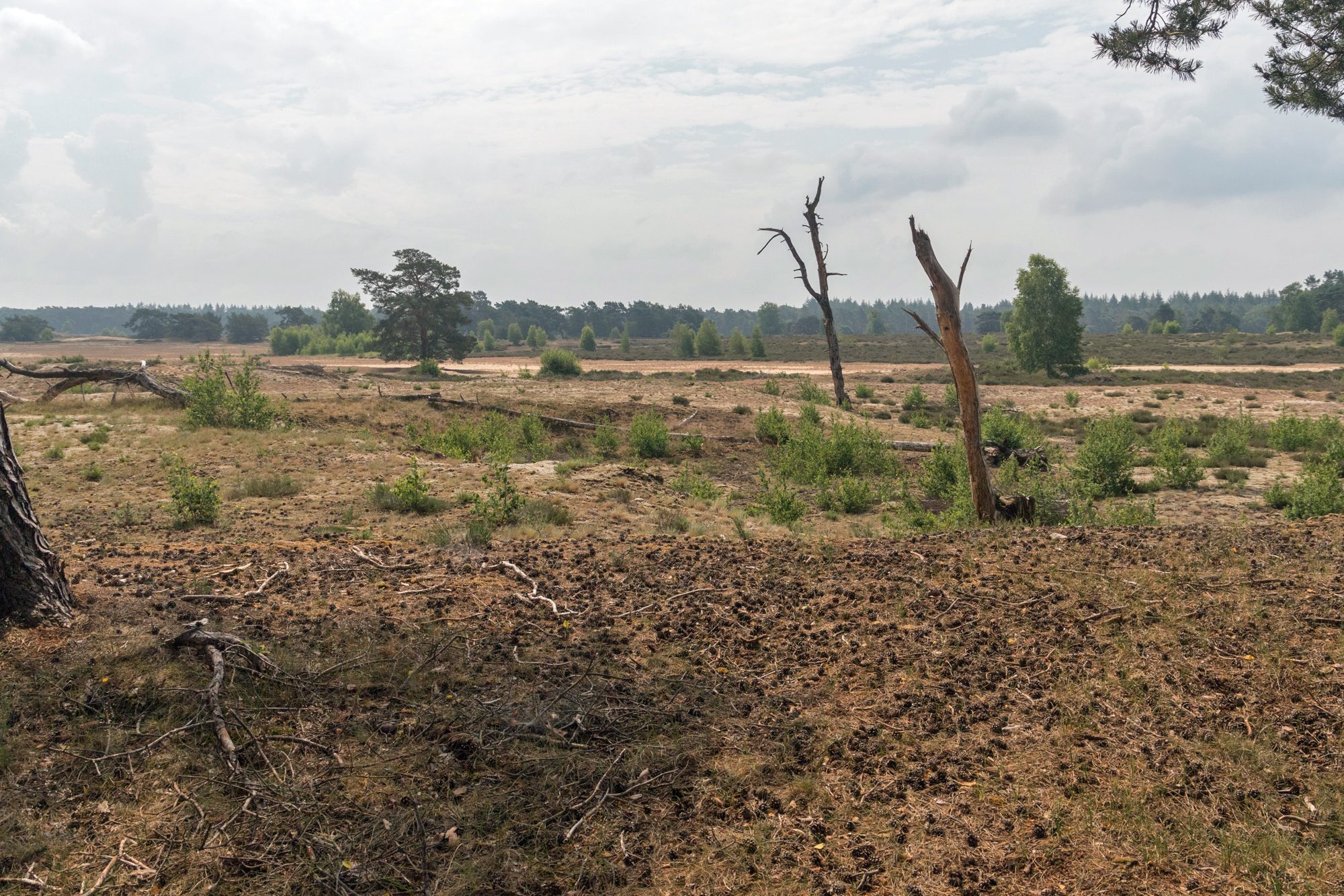
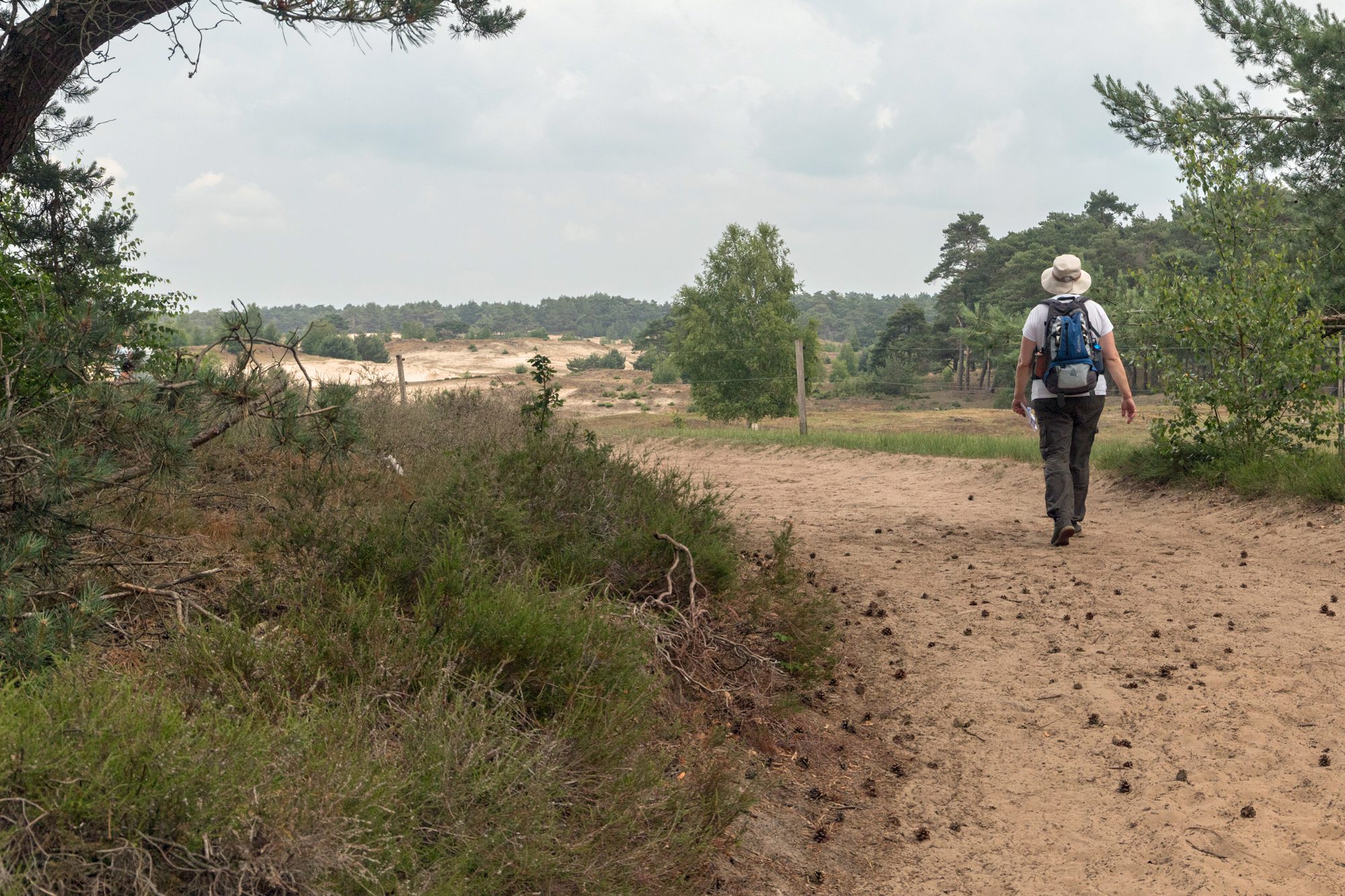
Sunday 14 June 2020, Wekeromse Zand near Wekerom, Province Gelderland, 8 km
The “Wekeromse Zand” is one of the last remaining ‘drifting sand’ areas in The Netherlands This (circular) hike has entered our personal top 10; very varied, abundant wildlife (birds, insects), primarily off road tracks and cyclists are kept at a distance apart from some mountain bikers… Some ancient burial hills as well, the Celtic fields, ice ages stone and other landmarks and you might even encounter Mouflons. We started our hike at the parking along the Vijfsprongweg near the replica of an iron age farmhouse. .
Sandy or muddy depending on the weather, so sturdy footwear recommended. We tried to follow the ‘red route’ but despite or maybe because of the numerous signposts we navigated primarily with our map.
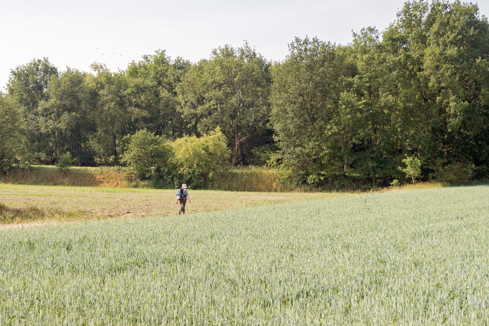
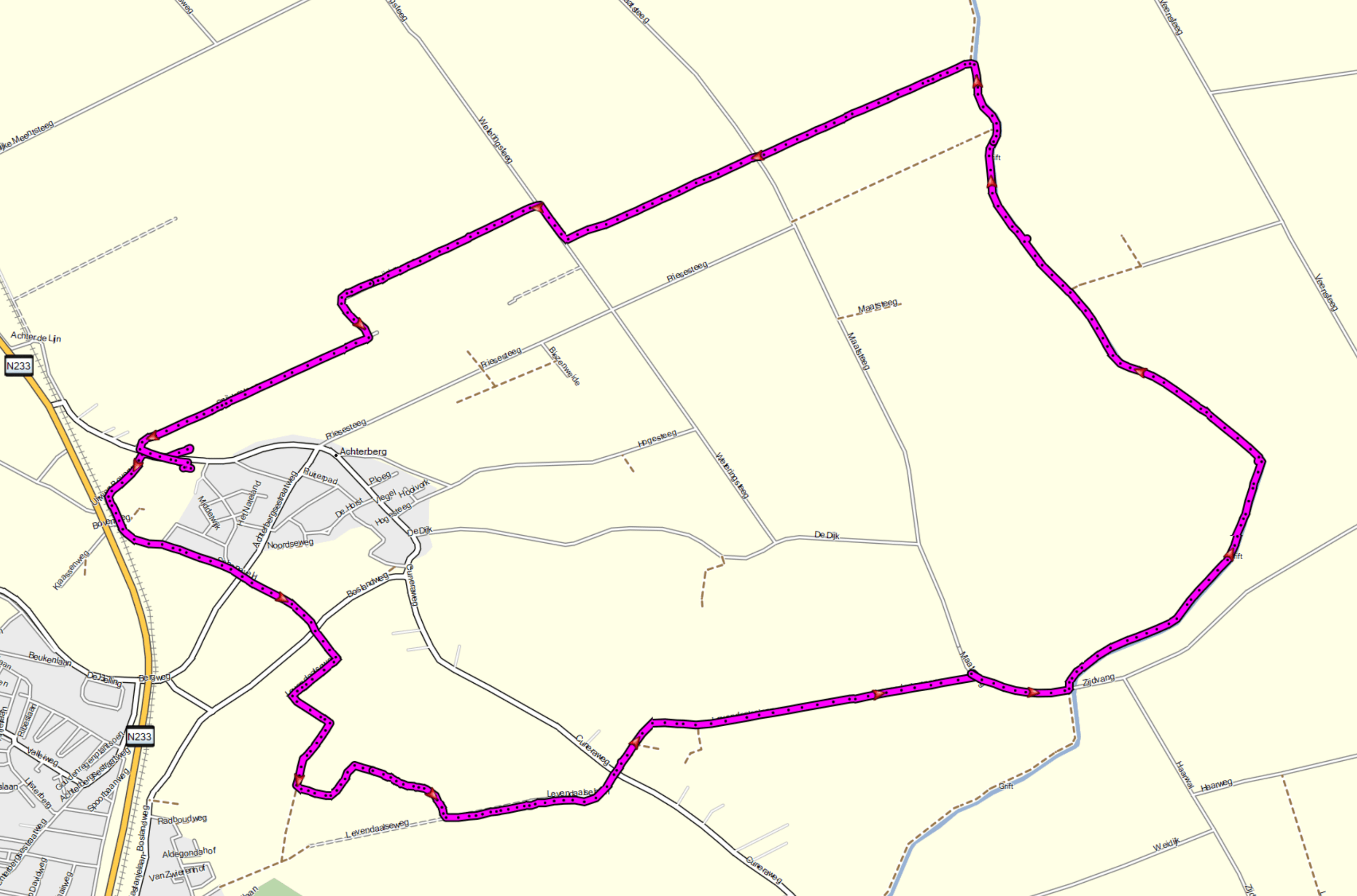
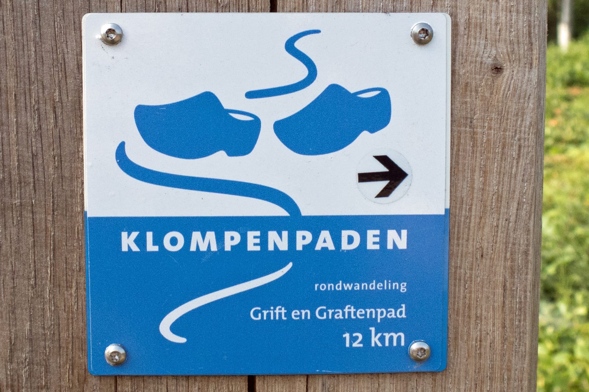
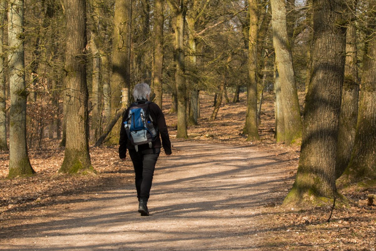
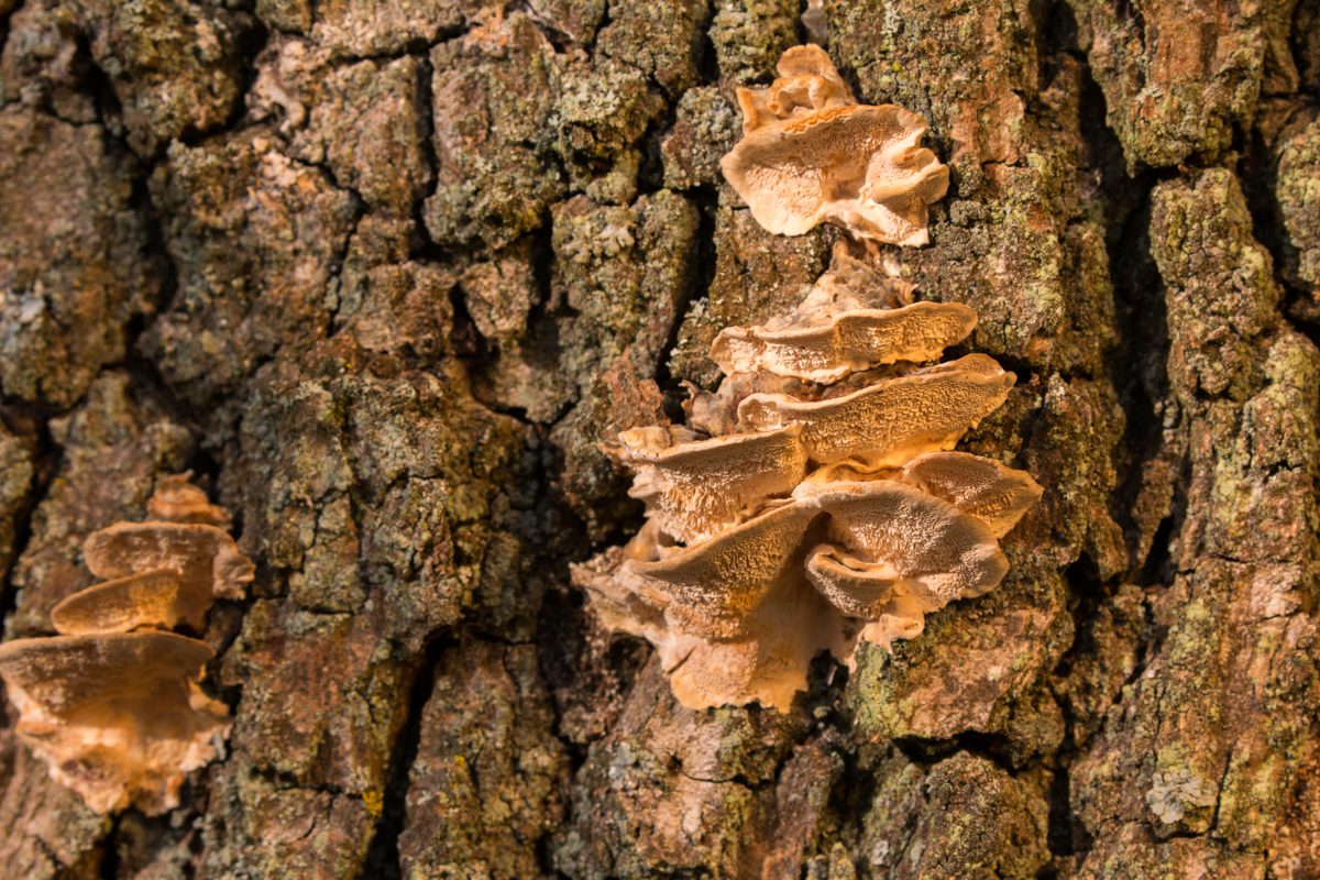
Wednesday 3 June 2020, Grift en Graftenpad, nr Achterberg, Province Gelderland, 10.5 km
Varied walk near a historic area (war history Grebbeberg) and trough a typical Dutch agricultural landscape and serious attempts to combine this with sustainable natural landscape and leisure facilities. Again a nice ‘Klompenpad’ (wooden shoe path) partly through fields. Part of the walk is on relatively busy and a bit boring tarmac cycle path so make sure you pick a day with scenic clouds for some distraction. Sturdy, waterproof hiking boots or ‘Wellies’ only necessary on a short route through the fields. This track is really recommended. The path is well maintained and signposted. More details (in Dutch): https://klompenpaden.nl/klompenpad/grift-en-graftenpad/
Sunday 21 April 2019, Brummen near Zutphen and Dieren, Province Gelderland, 9.5 km
There are a many hiking tracks available in this scenic area near the river IJssel and the largest naturereserve in The Netherlands; Veluwe. We decided to use the track of the local Red Cross as a bases and varied somewhat.
Varied scenery; cultured forest and typical agricultural landscapes… easy going, bit too much tarmac for our taste (hence our detours) but the roads are pretty quiet so it’s not a real issue. An exceptionally warm and bright Easter-day with temperatures soaring up to 25 C! Starting point is near Café de Vroolijke Frans…
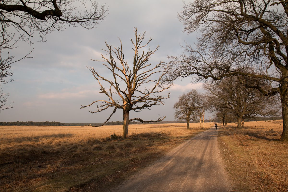
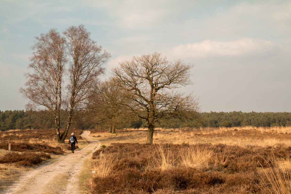
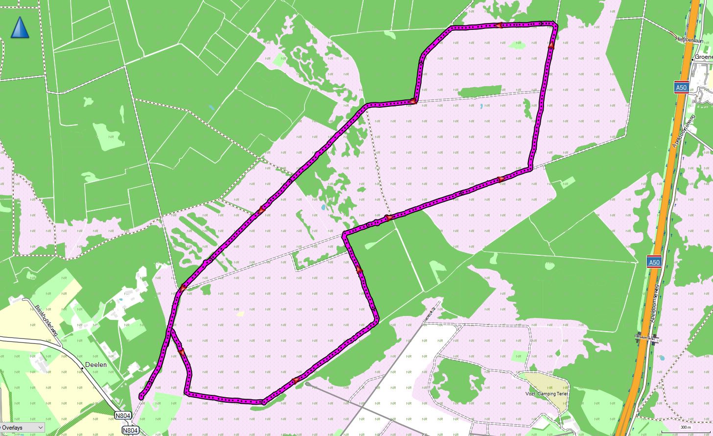
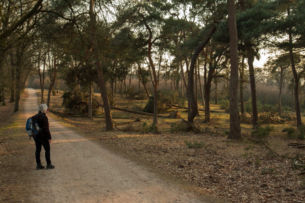
Saturday 24 March 2018, Deelerwoud, Deelen, Province Gelderland, 9 km. Late afternoon reconnaissance of the Deelerwoud trail in the eastern part of The Netherlands. Walking anti-clockwise the route takes you around a large open area (hey) close to Deelen AFB (helicopters only) and west of the famous airfield for gliders ‘Terlet’. Well marked, easy going. Nice views and you might even spot some deer. The only disadvantage is the proximity of the highway A50, especially with the wind blowing from the east. When looking at the last picture; yes, the winter storms have taken their toll on a lot of places around the track but the trees are left like that on purpose for the diversity and health of the forest.
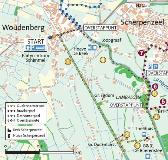
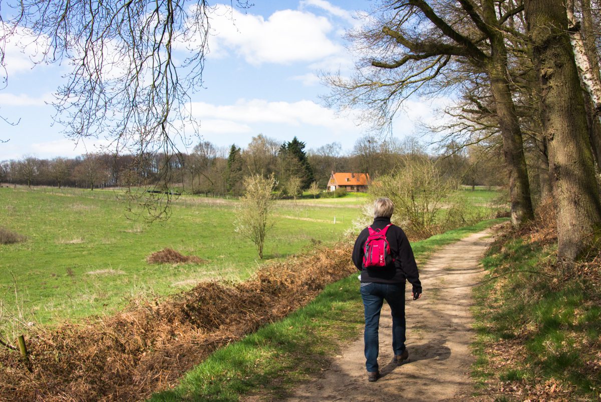
Sunday, 6 August 2017, Oudhorsterpad, Woudenberg, Province Gelderland, 7,5 km (GPS 8.5 km). On track again.. this time a ‘Klompenpad’ (wooden-shoes (farmers) -trail) in particular the Oudhorsterpad. Walking anti-clockwise it starts off with a long straight path following a former railroad track. As this is relatively high above the countryside – like on the way back where the path follows a dike – it provides some excellent views – weather permitting – so it’s hardly boring. Apart from that a very varied footpath and in the final stage you are treated with some interesting history lessons as this area has been part of Dutch defenses – making the most of our wet landscape – for many centuries.
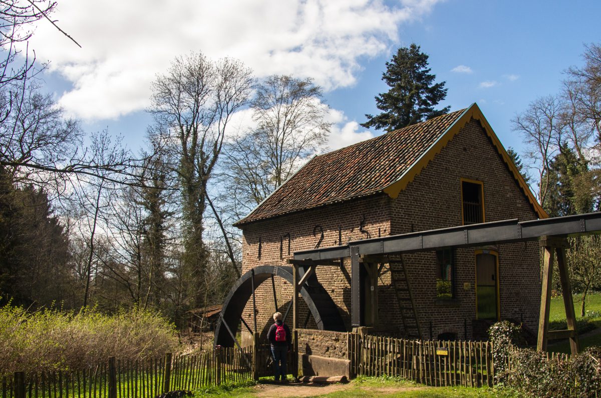
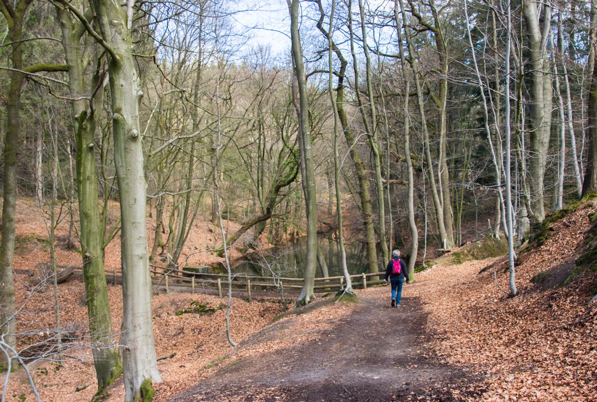
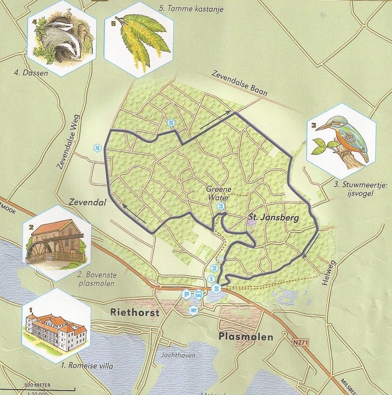
Saturday 20 April 2013, the “Keikberg” route near Plasmolen in the province of ‘Gelderland’: Wandelrouteboek route 89; 6 kilometers.. (St. Jansberg). The description was promising…. ‘non-Dutch beautiful scenery’… turned out to be the truth… very accented trail (climb and descent) with great views… Well marked and no tarmac… Make sure to have a look at the watermill “Bovenste Plasmolen” and visit the reconstruction site of the Roman Villa.. (both near the start of the hike north of the village of Plasmolen…). If you like you can extend the hike by approximately 5 km in the North across the Mokerhei. Well marked; you are offered the choice somewhere halfway this hike…And yes… we spotted a Kingfisher (IJsvogel in Dutch